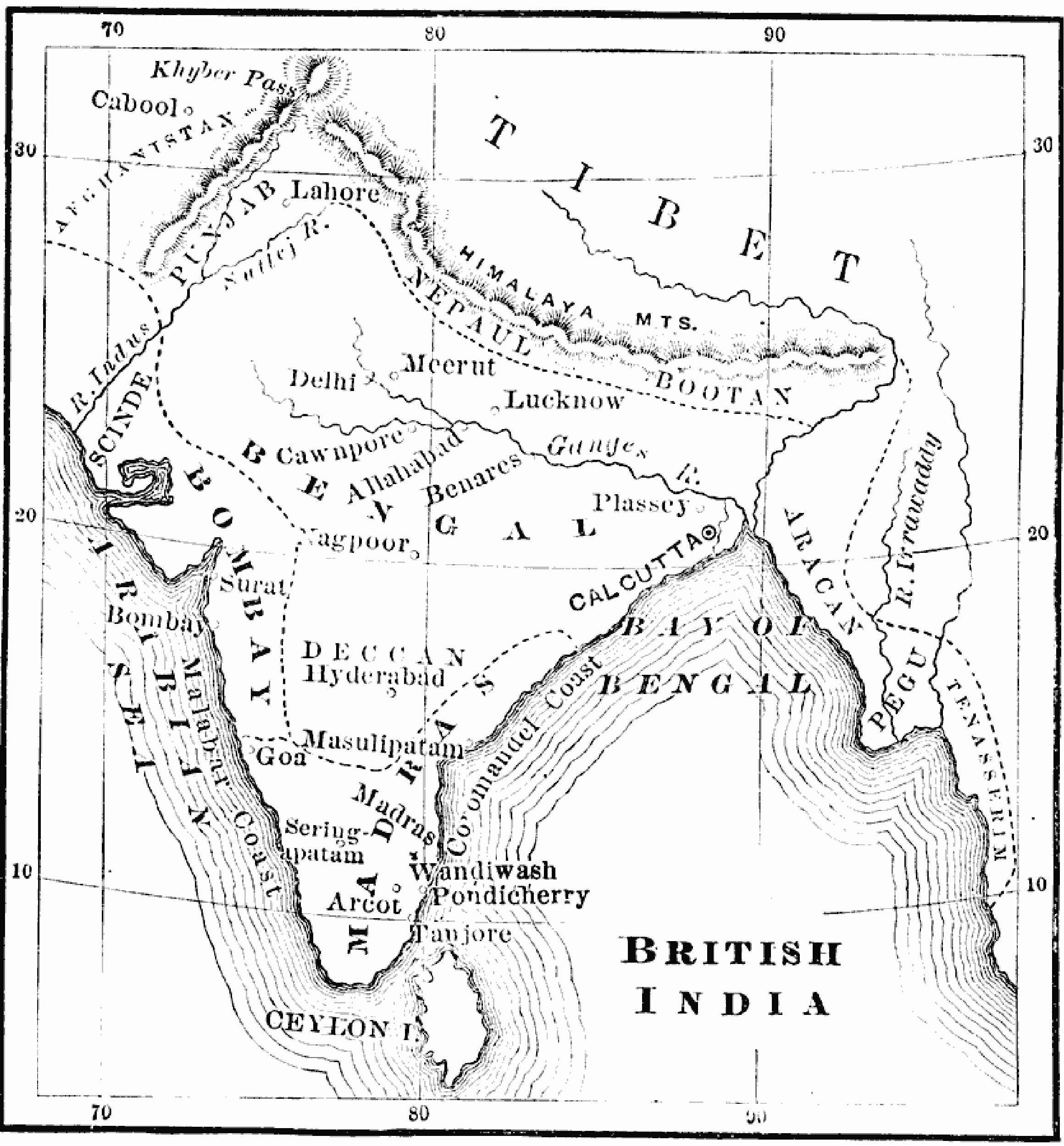
British India, 1744–1774
Click image to open full view
ARCMAP100202
DESCRIPTION
A map of British India during the reign of King George II (1727–1760) and British Major–General Robert Clive's campaigns in India (1744–1774). The map shows Calcutta as the capital at the time, and shows the territory of Bengal extending from the Indus and Sutlej rivers in the west to the mouth of the Ganges River in the east, and the territories of Bombay, Madras, Aracan, and Tenasserim. Major cities, rivers, and the boundaries of Nepal and Bootan along the Himalaya Mountains are shown. Mughal Library