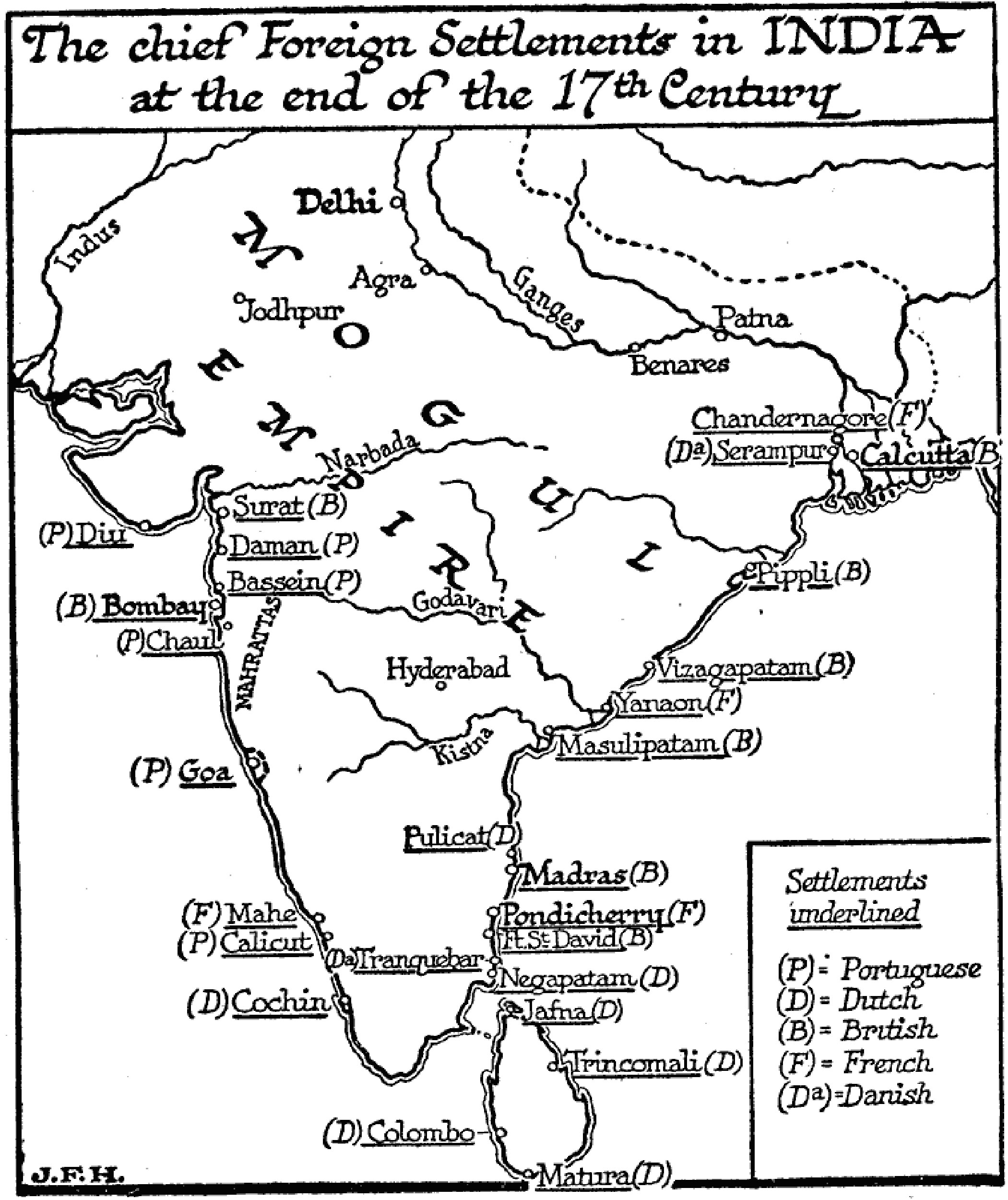
Chief Foreign Settlements in India, 1650–1700
Click image to open full view
ARCMAP100201
DESCRIPTION
A map of the coastal foreign settlements in India and Ceylon (Sri Lanka) at the end of the seventeenth century. The settlements are underlined with the controlling foreign power noted in parentheses, including the possessions of the Portuguese (Diu, Daman, Bassein, Chaul, Goa, and Calicut), Dutch (Cochin, Colombo, Matura, Trincomali, Jafna, Negapatam, and Pulicat), British (Surat, Bombay, Fort St. David, Madras, Masulipatam, Vizagapatam, Pippli, and Calcutta), French (Mahe, Pondicherry, Yanaon, and Chandernagore), and Danish (Tranquebar and Serampur). This map illustrates the coastal limits of foreign possessions of the period, prior to the inland expansion, most notably by the British under the East India Company. Mughal Library